

Where flood risk also needs to be assessed, the drainage strategy should be coordinated with an FRA for your planning application so that flood-risk mitigation and drainage design are consistent.
For wider advice across a development, RIDA also provides planning and development drainage consultancy from early planning through to detailed design.
RIDA’s summary of the current policy changes is set out in the August 2026 NPPF flood risk and drainage update.




The strategy considers how surface water run-off changes as a result of development and identifies an appropriate discharge route. This may involve reuse, infiltration, discharge to a watercourse, a surface-water sewer or another route where the preferred options are not feasible and the relevant approvals can be obtained.
Drawings can show proposed drainage routes, SuDS features, attenuation areas, discharge points, flow-control structures, foul and surface-water connections and exceedance flow routes. These drawings allow drainage to be coordinated with buildings, roads, levels and landscaping before detailed design.
Where foul drainage is relevant, the strategy can identify the proposed foul drainage route, likely connection points and any consultation or capacity constraints that need to be resolved as the project progresses.
Projects that need a developed foul network can progress to RIDA’s foul drainage design service.
A surface water drainage strategy explains how rainfall generated by the proposed development will be managed on and around the site. The approach should be proportionate to the development and should demonstrate how runoff will be controlled, stored, conveyed and discharged.
The strategy should consider the drainage hierarchy and the practical opportunities available at the site. Where infiltration is proposed, suitable ground information and infiltration testing may be required before the final system can be confirmed. Where discharge to a sewer or watercourse is proposed, the necessary capacity, consent or connection requirements should be identified.
For sites where mapped flood risk is a design constraint, our flood risk assessment consultants can coordinate the drainage strategy with the wider flood-risk evidence.
You can also review the latest changes to the available evidence in our 2026 surface-water planning data update.
A SuDS strategy, or sustainable drainage strategy, sets out how sustainable drainage measures will be used to manage surface water as close to its source as practicable. The preferred measures depend on the available space, levels, ground conditions, discharge opportunities, development layout and the requirements of the reviewing authority.
Potential measures can include permeable paving, swales, rain gardens, basins, ponds, infiltration systems, soakaways, below-ground attenuation and other source-control features. A good strategy also considers how these features will be accessed, maintained and operated over the lifetime of the development.
Read RIDA’s definition of Sustainable Drainage Systems (SuDS) for a concise explanation of the concept.
Where the project is moving from strategy into engineering design, see our sustainable drainage systems design service.
Drainage calculations are used to test whether the proposed system has sufficient capacity and whether runoff can be controlled to an acceptable rate. Depending on the development, the assessment can consider design storms, climate-change allowances, discharge controls, attenuation storage and the interaction between surface levels and the drainage network.
The strategy should also identify safe exceedance flow routes so that water has a controlled route if rainfall exceeds the drainage system’s design capacity.
This is particularly important on constrained sites where roads, thresholds, retaining features or existing buildings can influence overland flow paths.
A drainage strategy may be requested where a planning application changes how surface water or foul water will be managed. Requirements vary between authorities and should be checked against the development type and site constraints.
If you are at an early feasibility stage, RIDA’s Flood Map for Planning can help identify relevant mapped flood constraints before detailed work begins.
Send us the information you already have. We can identify what is missing and what is actually required for the drainage strategy rather than asking you to commission unnecessary information at the outset.
Drainage submissions are often delayed because a key assumption has not been demonstrated or because the drainage solution has been developed after the site layout is already fixed. RIDA aims to resolve these issues at strategy stage.
The report proposes infiltration, a watercourse or sewer connection without enough evidence that the route is feasible.
Storage or discharge assumptions are not supported by suitable calculations.
Buildings, roads and parking leave insufficient space for an appropriate sustainable drainage solution.
The proposed layout conflicts with the way water currently moves across the site.
The strategy does not demonstrate where water will go if the drainage system is exceeded.
The two systems are considered separately and create avoidable design or connection problems.
Local strategic documents such as Surface Water Management Plans can also influence how surface-water issues are understood in a particular area.
RIDA can progress an accepted strategy into site drainage design including calculations, levels, pipework, structures and construction drawings.
This separation keeps the planning strategy focused on proving the approach while allowing the later detailed design to respond to final levels, architectural coordination and construction requirements.

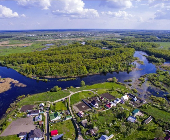
The Old Farmyard at Little Coxwell, Faringdon required a surface-water strategy and detailed drainage design to address planning conditions on a constrained redevelopment. RIDA reviewed the existing drainage arrangements, developed a SuDS-led solution, carried out hydraulic calculations and mapped exceedance routes so that rainfall could be safely managed without creating additional risk to the buildings.
See the full drainage strategy and SuDS project example for the site constraints, design response and outcome.
Planning and engineering combined: The strategy is written for planning but developed with the practical requirements of later design and construction in mind.
Surface water and foul drainage expertise: RIDA can coordinate drainage strategy, SuDS, foul drainage and detailed drainage design as the project develops.
Experience with constrained sites: Support is available for sites affected by difficult levels, restricted discharge routes, surface-water flooding, groundwater constraints and limited space.
Clear advice: The report explains the proposed drainage solution, calculations and assumptions in a form that planners, architects, developers and engineers can use.
Fast, fixed-scope delivery: Where the project information and scope allow, RIDA retains its established 5-day drainage-report service.
If you are uncertain about your requirements, give us a call, we are happy to talk you through the options.
We have had the pleasure of working with Arge at RIDA over several years and throughout this time the experience has consistently been very good. What stands out most is their responsiveness - any queries or issues have always been addressed promptly, which has given us great confidence and peace of mind.
It depends on the development, site constraints and local validation or consultee requirements. A strategy is commonly required where development changes surface-water runoff, needs a defined discharge route, introduces SuDS or requires drainage evidence to satisfy the LPA or LLFA.
No. A Flood Risk Assessment evaluates flood risk affecting or created by a development. A drainage strategy explains how surface water and foul drainage will be managed. On many sites the two documents should be coordinated.
Where surface-water drainage is relevant, the strategy should consider appropriate Sustainable Drainage Systems and show how runoff will be managed in line with the applicable drainage hierarchy and local requirements.
Where foul drainage forms part of the development, the strategy can identify the proposed foul route, likely connection points and any coordination or consultation requirements.
If the drainage strategy relies on infiltration, testing may be required to demonstrate that the ground is suitable and to provide the parameters needed for drainage calculations.
Requirements vary, but submissions can include layouts showing drainage routes, SuDS features, attenuation, discharge locations, foul connections and exceedance flow routes.
RIDA currently promotes Drainage Strategies in 5 Days. Delivery depends on receipt of sufficient project information, third-party data and project complexity.
Send us your site location and proposed development drawings. Our drainage team can review the available information, identify the likely drainage requirements and provide a fixed-price quotation for the appropriate level of assessment.