Contact us to get a free quote
Our success is based on clear communication and excellence relationship with Harrow Borough Council
Our highly experienced chartered engineers are abreast of the latest legislation and flood modelling data to protect your development from flooding and make it a reality.
Our expertise enables us to provide full range of services for any size development. We are able to create river models and assess your development within flood zone 2 and flood zone 3.
Our flood risk assessment provides a detailed analysis Harrow Borough council flood risk information proving specific mitigation strategies that apply to your development.
Our expertise allows us to leverage mapping systems to give your site the best chance to get planning approval
You receive clear and specific advice which:
Meets the local and national planning policies
Costs effective in the mitigation o flood risk
Enables you to make informed changes to the design and achieve planning
Safeguard your development from flooding throughout its lifetime
Contact us today on 01608 510121 or get a free quote
Our prices are fixed and or reports are delivered on time. Join the developers, architects and consultants that had their planning approved
Our Reports
If you are uncertain about your requirements, give us a call, we are happy to talk you through the options.
Contact us today on 01608 510121 or get a free quote
The benefits of using our flood risk assessments for your planning application
You receive the first reports in 48hrs. This allows you to get a full review on your design
Reduced the time and costs associated with delayed planning applications
Increased chances of obtaining planning permission for your developments
Fixed price for all our flood risk assessments
We support you through the planning application until a decision is made
Our Flood Risk Assessment methodology
We work collaboratively with architects, planning consultants, Harrow Council Infrastructure Department and the Environment Agency to give your development the best chance to get planning.
The flood risk assessment methodology includes:
Obtaining your development’s drawings and levels
Consulting and obtaining all relevant flood risk information
Liaising with the Environment Agency and Harrow Borough Council to understand their requirements
Calculate the flood compensation storage
Providing clear advice on how to mitigate the risk of flooding
Providing a drainage strategy (if included as part of pricing)
Our flood risk assessment methodology is based on obtaining the best possible data and using our engineering judgement and experience to get your development through planning.
What is included in our Drainage Strategies
A sustainable drainage strategy should be provided as part of the flood risk assessment. Discharging water to the combined drainage system is not acceptable. A drainage strategy must include:
Drainage strategy layout drawing
Details of surface and foul water connections and their outfall details
Agreement in principle with the local water company for discharging foul and surface water flows into their network
Soakaway test results
Construction details of the soakaway and details of the flow control devices
Full set calculations in compliance with the suitable drainage system principles
If there is a basement a description on how groundwater flows are managed and approval in principle of groundwater flow discharge flows
When would you get your flood risk assessment?
You will get the initial flood risk assessment in 48hrs of our appointment
We start the discussions with the council right away and with your design team to get the flood risk assessment and drainage strategy completed.
These timescales vary dramatically depending on the complexity of the site and the availability of information and people to complete or provide the information required.
In general, the fastest report that has been approved without comments is two weeks. The longest is one month and half.
If you have a complex site. These are the typical timescales:
When do I need a flood risk assessment?
Harrow Borough Council is one the most advanced councils in England in proactively managing surface water flooding. You need a flood risk assessment if your development falls within:
The Environment Agency Fluvial Flood Zone 2 or 3
The Environment Agency Flood Map for Surface Water 1 in 100 years (flood zone 3a)
The Environment Agency Flood Map for Surface Water 1 in 30 years (flood zone 3b)
It is affected by other sources of flooding
It is more than 1 ha within flood zone 1
Developments falling under Environment Agency Flood Zone 2 and 3 are subject to consultation with the Environment Agency and Harrow Council.
Development proposals falling within the Flood Map for Surface Water are subject to consultation with Harrow Council.
Specific requirements for Harrow Borough council flood risk assessments
The specific food risk requirement in Harrow Borough council are:
As the council does not provide the flood levels, then we need to make an assessment on the maximum flood level at the site. This level is then agreed with the Council
The design is completed for the worst-case scenario and uses the highest flood depth which affects the development
In minor developments (less than 10 houses or 2500m2) calculations should be based on a constant depth of floodwater
The constant depth of water is the upper limit of the flood depth level indicated in the flood map. - For minor developments, the storage volume is allowed in the flood zone
We recommend that the flood risk is looked at the start of the design process as this may influence whether your development is feasible.
Our Civil and Structural Engineering backgrounds ensures robust solutions that strengthen your planning approval whilst following the Harrow Borough Council advice for flood risk assessments.
Contact us today on 01608 510121 or get a free quote
Frequently Asked Questions
Why is Harrow Borough Council asking for a flood risk assessment when my house is clearly outside of the Environment Agency flood zone for planning?
Harrow Borough Council looks after flood risk from surface water under powers given by law by the Government. As per picture below. This is water that flood areas before it reaches the main rivers.
Harrow Surface Water Flooding
Harrow Borough council has instigated the same flood zone classifications given by the Environment Agency to their flood risk from run-off zones and has applied the same requirements stated under the National Policy Framework.
In other words, if you are in a run-off flood risk areas the same principles apply as if you were in a river flood risk area.
The Environment Agency river flood risk area is a shown below. The two sets of information vary dramatically.
Environment Agency Flood Zone Areas
Can I build my development within a flood run-off risk area?
It depends on the flood risk vulnerability classification and the location of the development within the flood zone.
If your development is compatible then you can build with the appropriate risk assessment. Otherwise, you may need an exception test to demonstrate that your development is necessary within the flood zone.
We can help you understand how to get your development underway.
Do I need to get the flood maps?
Yes, the Fluvial flood levels, surface water flood and surface water flood depth maps should be submitted as part of the flood risk assessment
Where can I get the flood maps and flood data?
The flood extent and surface water flood depth and risk maps can be requested from Harrow Borough Council Infrastructure Department.
Alternatively, the flood extent map(s) can be viewed on Harrow Borough Council website and the flood extent, depth and velocity maps can be viewed on the Joint West London SFRA
The river flood maps and levels can be requested directly from the Environment Agency and be seen in the Environment Agency flood map for planning.
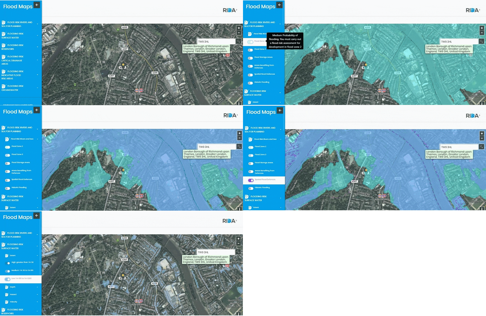
You can also look at our map. You will be able to see the risk of flooding from rivers or sea (planning), flooding from surface water and reservoirs or whether the development is affected by surface water run-off.
We have taken this information directly from the Environment Agency databases and prepared it so you can check in detail if your development need a flood risk assessment.
Do I need to pay for the flood maps?
The maps from the Environment Agency are free.
The flood maps from Harrow Borough Council incur charges as follow:
Surface Water flood extent map £47.35
Surface Water flood depth map £47.35
Surface Water flood velocity map £47.35
Surface Water flood hazard map £47.35
Extract of a detailed river network map £47.35
These charges are for the provision of the flood map and include a basic technical summary. The fee are paid directly to Harrow Borough Council
My development is in the flood zone what mitigation measures can apply?
The flood zone mitigation that apply depend on the depth of floodwater.
For instance, for shallow depth of water up to 300mm (1 foot), the best option is to keep the water out or locating the building above the flood levels. You can do this by including flood gates, walls, raising the final floor level of your property by 300mm above the flood level.
For deeper depths of water, you will be looking at building materials, foundations, floor, walls, fittings, services, doors and windows that minimise water entry whilst maintaining structural integrity.
For water entry, we look at materials and construction techniques that facilitate drying and cleaning.
Our mitigation strategy will be in line with the CLG 2007 'Improving the Flood Performance of New Buildings' publication.
What is a Compensatory Flood Storage?
Harrow Borough Councils flood risk team request that a compensatory flood storage volume is calculated for all developments within surface water flood zone 3a and 3b.
The Environment Agency also requests compensatory flood storage for developments located in flood zone 3 and 2.
The compensatory flood storage for both cases should comply with the following requirements:
It should be provided on level for level and volume for volume basis by gradually lowering ground levels
Flood water with the storage should flow freely out of the lowered area when flooding recedes
It should be located next to the flood zone wherever possible
The volume of the CFS provided must be equal to the volume of floodwater displaced by the development
What are the differences between the Environment Agency and Harrow Borough compensatory flood storage assessment?
The main difference is that the Environment Agency provides the flood levels for zone 3 and zone 2 while Harrow Borrow only gives the map showing the extent of the flooding without levels.
In order to carry out both assessments, we need to know the level of the existing and proposed site in mAOD and a topographical survey is required.
What do I need to submit as part of the compensatory flood storage?
For both authorities (The Environment Agency and Harrow Borough Council) the following information is required:
Site plan indicating the proposed and existing development
Flood zone showing the extent and depth of the flood area for the existing and proposed development
Calculations showing the proposed area of displaced flood water and the compensatory storage area
Cross-sections showing proposed and existing ground levels in relation to finished floor levels
Digital terrain model showing the flood in relation to the development
Contact us today on 01608 510121 or get a free quote
What are the additional costs to get all the information?
This is the additional work that is required to complete the flood risk assessment and drainage strategy and its costs:
Topographical survey cost £400/£600
For small extension Satellite LIDAR data can be used as long as the final floor level of the property is known. Cost: £80/£120. We need to agree using this data with the council before we can proceed.
Obtain the flood data from the council. Cost: £189.40 approx
Sewer records from Thames Water. Cost £59.76
Soakaway Tests. Costs £900-£2,500
Consultation with the council. Costs: £110.5/hr. Payment is done directly with the council
We know local suppliers who can provide quotes and get the information fast. Contact us to get a better indication of costs and timescales
Get in touch with us
Call Arge on 01608 510 121 or e-mail him at arge@rida-reports.co.uk
BEng(Hons) MSC CEng MICE MCIWEM C.WEM CEnv


